|
The Sandrat Trail, also known as the "River Trail". It's a very-runable,
fairly smooth, and nicely shaded trail between the levee and Kaw River just north of Downtown Lawrence.
The trail is a good place to have a "recovery run" after an injury; at least
that's what some of us think. With its short, rolling hills and smooth, fast surface, it is a very forgiving course
to run on. It's also a blast to run a quick tempo run on, whether or not you are a trail runner or pavement-pounder,
it's just good fun.
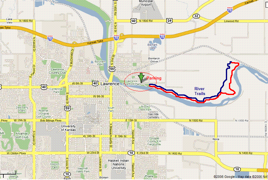
Directions from I-435 and KS-10 W, in Johnson County,
KS
Head west on K-10 to Lawrence (26.7 mi)
Turn right at S Massachusetts St, head north through downtown (2.1
mi)
Cross over Kaw River on bridge.
Turn right at E Elm St
Turn right at N 4th St
N 4th St turns left and becomes
Walnut St
Turn right at N 8th St
Cross over levee
Park in parking lot
Or:
West on I-70 from Kansas City
Take first Lawrence Exit (40/59 Highway Exit)
Turn right
at E Elm St
Turn right at N 4th St
N 4th St turns left and becomes Walnut St
Turn right at N 8th St
Cross over
levee
Park in parking lot
Map to Parking Lot for the River Trail
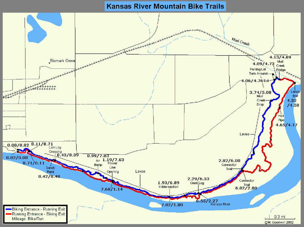
TRAIL MAP
This trail is used in the annual Sandrat Trail Run. It's a fairly smooth, very fast trail, with very few rocks and roots.
All of its hills are small "rollers" and are very runable. It drains well after a rain, except for its east side.
This trail has mountain bike traffic. DO NOT WEAR HEADPHONES, AND
YIELD TO MOUNTAIN BIKES! (Unless you like being flattened by a knobby-tired Klein).
| Click on Map to Enlarge image |

|
| Click on Map to Enlarge image |
| Click on Map for larger image |

|
Run carefully!
|
